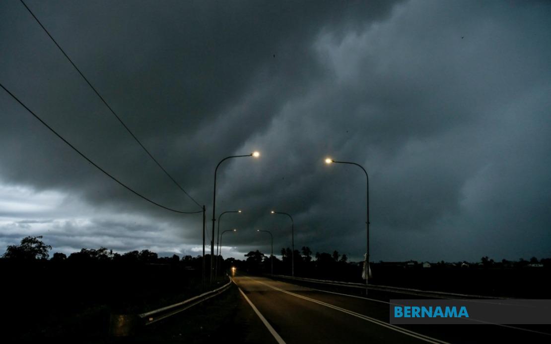
The Malaysian Meteorological Department issued a widespread weather alert on June 18 affecting major portions of the country, warning of thunderstorms, heavy rainfall, and gusty conditions set to continue through the evening hours until 9 pm. The advisory reflects the increasingly unpredictable weather patterns that have characterised the region's transition periods between monsoon seasons, when atmospheric instability frequently generates sudden electrical storms across the peninsula and island states.
The northern region faces particularly acute risk, with the entire state of Perlis placed under alert alongside significant portions of Kedah and Perak. In Kedah, the warning encompasses Langkawi, Kubang Pasu, Kota Setar, Pokok Sena, Padang Terap, Sik and Baling, while Perak's affected zones include Kerian, Larut, Matang and Selama, Kuala Kangsar, Kinta and Kampar. These areas, many of which are densely populated or home to significant agricultural and industrial operations, face disruption to transportation networks and potential flooding in low-lying regions.
Central peninsular states have not been spared from the weather system. Pahang's Cameron Highlands, Bentong, Bera and Rompin districts are included in the warning, alongside Selangor's Hulu Langat region and specific areas of Negeri Sembilan comprising Jelebu and Jempol. The inclusion of these interior and upland regions suggests the storm system possesses sufficient vertical development to impact even elevated terrain, which typically experiences more stable atmospheric conditions. Meanwhile, Johor's southern districts of Segamat, Kluang and Mersing also face the threat, potentially affecting the transport corridor linking the peninsula to Singapore.
Sarawak's extensive geography means numerous districts across the state experience the forecasted severe weather. Kuching's peripheral zones of Bau and Kuching town itself, together with Serian and Samarahan districts including Samarahan and Asajaya, sit under the alert. The warning extends to Sarikei's Meradong area, the Sibu division, and Mukah's Tanjung Manis locality. Interior divisions including Kapit, with its Song and Kapit districts, along with Bintulu's Tatau and Sebauh zones, have also been flagged, while Miri's Marudi district and the entire Limbang division fall within the cautionary zone.
Sabah similarly confronts widespread atmospheric disturbance across multiple regions. The state's interior zones including Sipitang, Kuala Penyu, Beaufort and Tambunan face the storm threat, whilst the entire west coast region remains under watch. Sandakan Division's Tongod and Kinabatangan districts have been included in the meteorological department's assessment, reflecting the comprehensive nature of the weather system affecting the island of Borneo.
Thunderstorm warnings carry serious implications for daily operations across affected regions. Transportation infrastructure becomes vulnerable to disruption, with heavy rainfall potentially reducing visibility and causing hydroplaning hazards on major highways and rural roads. The northern states particularly depend on reliable road networks for agricultural trade flows and inter-state commerce, making even brief disruptions economically significant. Construction sites, outdoor industrial operations, and maritime activities face temporary suspension during the most intense periods of electrical activity.
For residents in affected areas, the evening hours demand heightened vigilance regarding personal safety and property protection. Lightning poses acute danger to individuals caught outdoors, and open structures or inadequate shelters offer minimal protection against direct strikes. Household and business preparedness becomes essential, including securing loose outdoor items that strong winds might dislodge and ensuring adequate drainage around structures to prevent localised flooding. Communities in flood-prone zones should remain alert for rising water levels, particularly in areas where saturated ground conditions already exist from preceding rainfall.
The timing of this alert through the evening hours creates particular challenges for commuters and evening activities. Rush hour traffic coinciding with the onset of severe conditions may increase accident risks substantially. Schools and institutions should evaluate whether early dismissal or activity modifications are warranted based on developing conditions. Essential service providers including healthcare facilities, utilities, and emergency response teams typically prepare contingency plans during such warnings to maintain operational continuity.
For the agricultural sector, the warning carries mixed implications depending on crop type and growth stage. While rainfall provides moisture essential for crop development, excessive downpours can damage certain crops, cause soil erosion on slopes, and disrupt harvesting operations. Rubber plantations across the peninsula and agricultural zones in Sabah and Sarawak must balance the benefits of precipitation against potential flooding and wind damage to mature trees.
The geographic scope of this warning—spanning from Perlis in the far north through the central peninsular states and across both major states on Borneo—indicates a significant atmospheric system rather than localised convective activity. Such widespread thunderstorm patterns typically develop when moisture-laden air masses encounter differential heating or orographic lifting, generating instability that manifests in explosive vertical cloud development. Understanding that evening hours often see intensified thermal convection adds urgency to the meteorological department's afternoon advisory.
Public response to such warnings has evolved in Malaysia through improved communication channels and increasing weather literacy among populations. Real-time alert systems, weather applications, and social media dissemination ensure that residents in remote areas receive timely information. However, compliance with safety recommendations requires ongoing education about thunderstorm hazards and appropriate response protocols.
The duration specified—until 9 pm—suggests meteorologists anticipate typical evening convective patterns, as thermal forcing diminishes after sunset and storm development typically weakens into the night. Residents in all affected areas are advised to monitor official updates from MetMalaysia throughout the afternoon, particularly as conditions develop, and to implement basic safety measures including remaining indoors during peak electrical activity and avoiding outdoor water-based activities until the warning concludes.