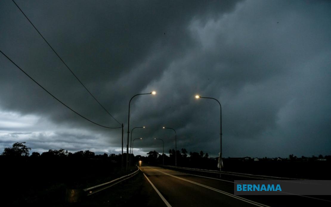
The Malaysian Meteorological Department has issued an urgent weather advisory covering extensive portions of the country, with thunderstorm warnings now in effect across Kedah, Perak, Kelantan, Pahang, Sabah, Sarawak, and Labuan. The alert remains operational until 1 am on June 19, giving residents and authorities limited time to prepare for deteriorating atmospheric conditions. Residents across the affected zones are being urged to exercise caution and monitor official updates closely as the weather system develops.
In Kedah, the warning extends to the districts of Padang Terap, Sik, and Baling, where atmospheric instability is expected to generate severe convective activity. These northern regions have been identified as particularly vulnerable due to their exposure to moisture-laden air masses, which typically accumulate during monsoon transitions and can rapidly develop into organized thunderstorm systems. The combination of terrain features and atmospheric moisture in these areas creates conditions favourable for intense precipitation events.
Perak's Hulu Perak district similarly faces the threat of intense electrical storms and associated hazards. The elevated terrain in this region, combined with prevailing wind patterns, often intensifies updrafts within developing storm cells, potentially leading to hail formation and lightning activity. Communities in this district should remain vigilant as such conditions can change rapidly and produce localized flooding in low-lying areas.
Kelantan experiences the most extensive coverage under this warning, affecting five districts: Tumpat, Pasir Mas, Jeli, Tanah Merah, and Kuala Krai. The northeastern state's exposure to the South China Sea and its relatively low elevation make it particularly susceptible to moisture convergence and storm development. The spatial distribution of affected districts suggests a organized weather system rather than isolated thunderstorm cells, indicating potential for sustained severe weather impacts across the state.
Across the peninsula, Pahang's Jerantut district faces inclusion in the warning framework, indicating that weather systems originating from the east coast are expected to penetrate inland. This pattern typically occurs when monsoon troughs shift westward or when tropical cyclonic influences extend toward the mainland. Jerantut's position makes it a gateway for such systems to affect the central highlands region.
Sarawak's extensive alert zone demonstrates the widespread nature of the meteorological threat, with warnings covering thirteen distinct regions spanning from Kuching in the southwest through the interior divisions to Miri and Limbang in the northeast. This comprehensive coverage suggests atmospheric conditions affecting the entire state simultaneously. The affected zones include major urban centers like Kuching and Sibu, as well as remote interior divisions such as Kapit and Bukit Mabong, where limited infrastructure may hamper emergency response capabilities.
In Sabah, the warning encompasses scattered locations reflecting the state's complex topography. The Interior district's Kuala Penyu, the West Coast areas of Putatan and Ranau, and the eastern divisions of Telupid and Beluran in Sandakan all face heightened thunderstorm risks. Ranau, situated at higher elevation in the interior, presents additional concerns as orographic effects may enhance precipitation intensity. Sandakan's coastal position in the east exposes it to direct moisture influx from the Sulu and Celebes Seas.
Labuan's inclusion warrants particular attention given its status as a small federal territory with limited geographic extent. The offshore location of this financial center makes it vulnerable to rapid atmospheric changes and sea state complications accompanying severe thunderstorms. Maritime activities and the territory's infrastructure warrant close coordination between weather monitoring agencies and emergency services.
The timeframe for this alert—extending through the early morning hours—suggests that meteorologists anticipate sustained convective activity throughout the evening and into the following day. Evening thunderstorms often represent the culmination of daytime heating effects, though the breadth of this warning indicates forcing mechanisms beyond simple diurnal heating cycles. Communities should prepare for potential disruptions to evening activities and ensure emergency supplies are accessible.
For Malaysian and Southeast Asian readers, such widespread simultaneous warnings demonstrate the region's vulnerability to large-scale atmospheric disturbances that can rapidly mobilize across multiple states and territories. The variety of terrain affected—from coastal zones to elevated inland regions—suggests meteorological forcing on a regional scale rather than isolated local phenomena. Residents in affected areas should heed official guidance, secure loose outdoor items, avoid unnecessary travel during peak storm hours, and maintain awareness of potential flash flooding, particularly in drainage-prone localities.